GeoSenseAI combines sensor, weather, and environmental data in real time. The AI analyzes risks and visualizes hazards in an interactive dashboard – enabling fast decisions and effective prevention.
From surprises to foresight: digital risk analysis

IoT-Integration
Connect your own and external sensors

AI analysis
Risk assessment powered by artificial intelligence

Hazard maps
Real-time visualization of risk zones
Reliable data. An advantage when it matters.
GeoSenseAI consolidates water levels, slope movements, and weather information in a central dashboard. Risks become visible in real time with customizable thresholds, trend analysis, and full documentation. This gives municipalities and operators control at all times, both in the office or in the field on mobile devices.
Interactive dashboard with real-time data: Water levels, ground movements, and weather data, visualized for faster decisions.
GeoSenseAI combines robust sensors with real-time AI analysis. The result: early warning systems that deliver reliable data even under extreme conditions, keeping municipalities and operators ready to act.
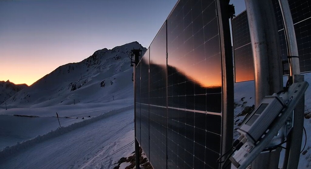
Solar and battery operation ensure long-term function, even during heavy rain, snow, or in remote alpine sites.
Seamless integration into existing systems such as disaster management software or GIS dashboards.
Real-time transfer via mobile, LoRaWAN, or satellite – for risk analysis without delay.
From single sensors to full monitoring networks: Easily expand your setup for additional hazards.
Sensor-as-a-Service: from individual stations to complete early warning systems. Transparent, scalable, predictable.
GeoSenseAI combines state-of-the-art sensor technology with artificial intelligence. This enables early detection of natural hazards and sustainable protection of infrastructure: From municipalities to railways, bridges, alpine huts, and energy supply.
Smart data for the Alpine region: Visitor flow measurement, water resource monitoring, weather stations, and more.
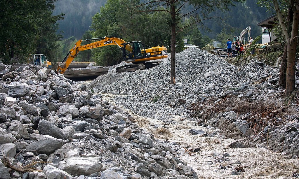
Monitoring of water levels, slope movements, and more: For greater safety in alpine regions and hazard zones.
Climate change adaptation
GMD® is a company that specializes in the prevention of natural hazards with self-sufficient, AI-based IoT sensor and radio networks with a machine learning GIS risk analysis platform to make natural events more predictable and offers and advises on customer-optimized climate change adaptation models for municipalities, ski resorts or infrastructure operators.
Neues Text-Element